Articles liés ŕ Super Scale London Street Atlas
L'édition de cet ISBN n'est malheureusement plus disponible.
Afficher les exemplaires de cette édition ISBN
Présentation de l'éditeur :
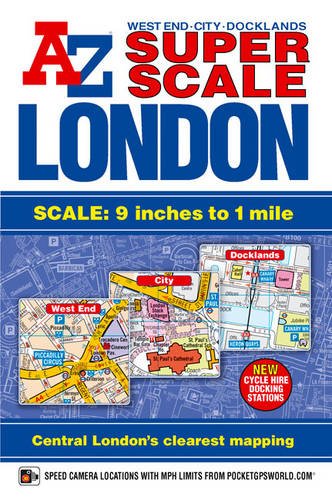
This paperback Super Scale Street Atlas of Central London has continuous coverage of the West End, City, Docklands and Stratford areas featuring large scale street mapping at 9 inches to one mile.
This continuous coverage extends to:
- Swiss Cottage, Camden Town, Islington, Hackney, Canning Town,Stratford, Beckton, London City Airport, North Woolwich, The O2 (Millennium Dome), Greenwich, Deptford, Vauxhall, Pimlico, Chelsea, Earls Court, Shepherd's Bush, White City, Kensal Green, Maida Vale and Kilburn.
Features on the street mapping include:
- Postcode districts.
- One-way streets.
- Safety Camera locations with their maximum speed limit.
- Red Light Camera locations.
- River Bus and River Boat Trip Piers.
- London Congestion Charging Zone boundary.
- Barclays Cycle Hire Docking Station locations.
Also included is an overview map of the congestion charging zone boundary and coloured maps of West End Cinemas and West End Theatres.
On the inside back cover is information about the congestion charging zone and the outside back cover features the London Underground Map.
The index section lists streets, selected flats, walkways and places of interest, junction, place and area names. There are separate index listings for hospitals and hospices and for the National Rail, Docklands Light Railway and London Underground Stations including River Bus and River Boat Trip Piers covered by this atlas.
Les informations fournies dans la section « A propos du livre » peuvent faire référence ŕ une autre édition de ce titre.
- ÉditeurGeographers' A-Z Map Co Ltd
- Date d'édition2014
- ISBN 10 184348739X
- ISBN 13 9781843487395
- ReliureBroché
- Numéro d'édition5
- Nombre de pages256
Acheter neuf
En savoir plus sur cette édition
EUR 49,44
Frais de port :
EUR 3,23
Vers Etats-Unis
Meilleurs résultats de recherche sur AbeBooks
Image d'archives
Super Scale London Street Atlas A-Z
Edité par
Geographers' A-Z Map Company Ltd.
(2011)
ISBN 10 : 184348739X
ISBN 13 : 9781843487395
Neuf
Paperback
Quantité disponible : 1
Vendeur :
Evaluation vendeur
Description du livre Paperback. Etat : new. New. N° de réf. du vendeur Wizard184348739X
Acheter neuf
EUR 49,44
Autre devise
Image d'archives
Super Scale London Street Atlas A-Z
Edité par
Geographers' A-Z Map Company Ltd.
(2011)
ISBN 10 : 184348739X
ISBN 13 : 9781843487395
Neuf
Paperback
Quantité disponible : 1
Vendeur :
Evaluation vendeur
Description du livre Paperback. Etat : new. Brand New Copy. N° de réf. du vendeur BBB_new184348739X
Acheter neuf
EUR 50,52
Autre devise
Image d'archives
Super Scale London Street Atlas A-Z
Edité par
Geographers' A-Z Map Company Ltd.
(2011)
ISBN 10 : 184348739X
ISBN 13 : 9781843487395
Neuf
Paperback
Quantité disponible : 1
Vendeur :
Evaluation vendeur
Description du livre Paperback. Etat : new. New. Fast Shipping and good customer service. N° de réf. du vendeur Holz_New_184348739X
Acheter neuf
EUR 49,96
Autre devise
Image d'archives
Super Scale London Street Atlas A-Z
Edité par
Geographers' A-Z Map Company Ltd.
(2011)
ISBN 10 : 184348739X
ISBN 13 : 9781843487395
Neuf
Paperback
Quantité disponible : 1
Vendeur :
Evaluation vendeur
Description du livre Paperback. Etat : new. New Copy. Customer Service Guaranteed. N° de réf. du vendeur think184348739X
Acheter neuf
EUR 49,89
Autre devise